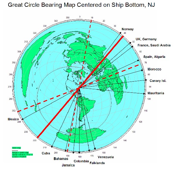
Great Circle map for Long Beach NJ
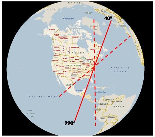
In this
map the thick red lines are BOG bearings, dotted red lines are
notional +/- 30 degree beamwidths for the antennas.
Here is another view showing just the Western Hemisphere; easier to see the individual states and countries in North and South America that lie on the beam of the antenna: